Forecasting
WPC QPF Overview
Mid-Atlantic RFC
State College Forecast
NDFD Graphical Forecasts
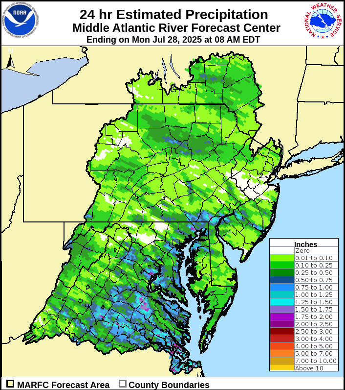
MARFC 24hr Precip Estimates
NWS Radar
HREF SPC
NCEP Model Guidance Page
DESI
WPC 500mb Clusters
WPC QPF Clusters
NBM Forecast Records
Extreme Forecast Index (EFI)
NHC
UWM Hurricane Page
NBM 1D Viewer
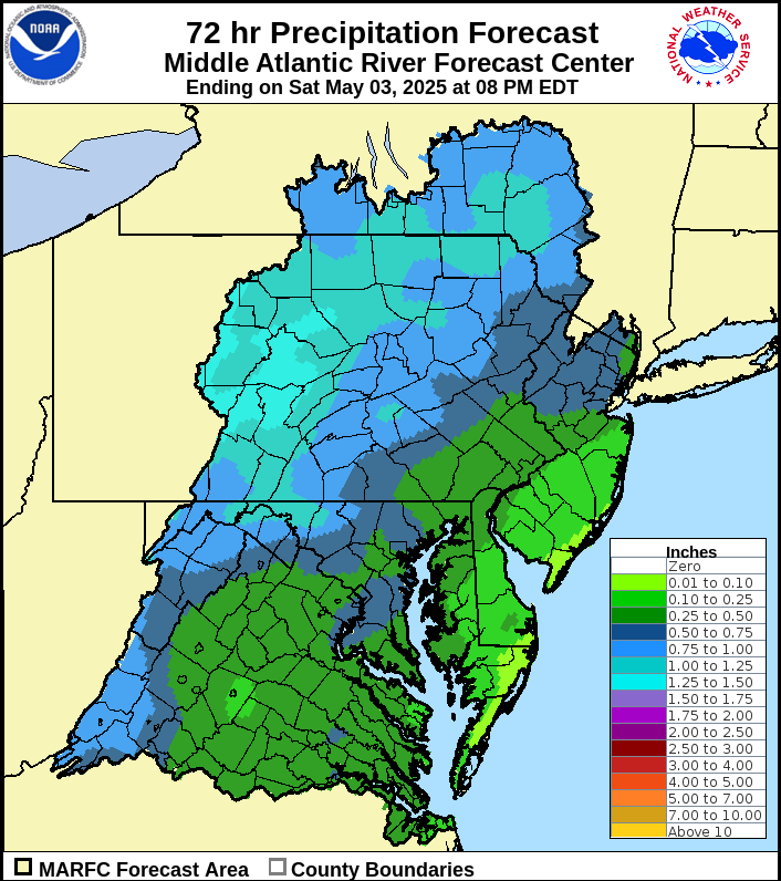
MARFC 72hr QPF
HRRR Experimental
HREF
NSSL CAMS Page
SPC SREF Page
SREF Plumes
NCAR WRF-DART Ensemble
NASA SPoRT
CIPS Historical Analog Guidance
SPC Sounding Climatology
Storm Prediction Center
Weather Prediction Center
Climate Prediction Center
Prob Precip Portal
|
Situational Awareness
SPC Mesoanalysis Page
NWS Enhanced Data Display
SR Hydro Decision Support Page
MRMS-NSSL App Launcher
mPing
Ensemble Situational Awareness Table
NDFD-derived Wind Map
NHC-driven Tropical Map
NWS GIS Viewer
NWS Snow Map
AirNow Air Quality Page
Reference
CAWCR Verification Info Page
AMS Advanced Journal Search
NCEP NARR Data
Plymouth State Product Generator
MMM Image Archive
Radar Status Page
Kriging and QPE
Stage IV EOL Page
Stage IV NWPS Page
Crane's Gage Analysis Page
Drought.gov NWPS Page
HDSC PMP Documents
NDSC Atlas Page
PSL Gridded Climate Data
Severe Weather Data Inventory
SPC Climatology Page
NCEI Storm Events Database
Gage data and networks
NWSLI
Gage Data Hub
CoCoRaHS
Mesowest
RAWS Climate Archive
CoCoRaHS Data Visualization
APRFC Metadata Page
Hourly Observations
NRCC
Miscellaneous
CPC ENSO Overview
Drought Monitor
AHPS Precip Estimate Viewer
USGS WaterWatch
NOHRSC Interactive Snow Map
Iowa Enviromental Mesonet
IEM NWS Text Product Finder
NWPS
USGS Dashboard
NWIS 24hr
NWIS Extended
NASA SPoRT Viewer River Forecasts
NYSMesonet SWE
NYSMesonet Snow Depth
USGS Rating Curve Page
NOAA Repository
CBRFC HEFS Page
CPC Briefing Page
WPC ARI Page
Operational Models Encyclopedia
MARFC NDFD GIS Graphics
David Roth Tropical Page
Radar Data By Day
MRMS Ops Viewer
MRMS Operational Product Viewer
NCAR-RAP METAR Data
MARFC Water Temperatures
Aviation Weather Center Obs
NWS Snow Map
Copernicus Browser
|